
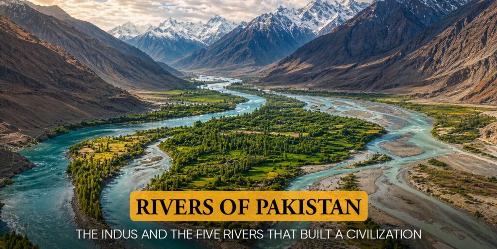
Rivers of Pakistan: The Indus and the Five Rivers That Built a Civilization
Long before Pakistan existed as a nation, its rivers existed as a civilization. The Indus River gave its name to India itself. The five rivers of Punjab, Jhelum, Chenab, Ravi, Beas, and Sutlej, gave Punjab its name: “Panj” meaning five, and “Ab” meaning water. Every major city, every agricultural plain, every ancient trade route in this land was positioned around a river.
Today, the rivers of Pakistan remain the country’s most essential geographic feature. They irrigate over 80% of Pakistan’s agricultural land, feed more than 220 million people, power hydroelectric dams, and connect the high Himalayan glaciers to the Arabian Sea through thousands of kilometers of flowing water.
In our earlier article, Geography of Pakistan Explained: Location, Rivers, Mountains, and Neighboring Countries, we introduced these rivers as part of Pakistan’s broader geographic story. This article goes deeper.
Here, we’ll learn about the Rivers of Pakistan and:
- Trace each river from its source to its endpoint
- Explore the history carried within their flowing waters
- Understand how these rivers have shaped the land over time
- Recognize their role beyond geography
- See how Pakistan’s rivers form the backbone of its past and future
A General View of The River System of Pakistan
Pakistan’s river system is part of the Indus Basin, one of the largest and most historically significant river systems in the world. The basin covers approximately 1.12 million square kilometers across Pakistan, India, China, and Afghanistan, with the overwhelming majority of its water use and irrigated land lying within Pakistan.
This river system is driven by two main sources: melting glaciers from the Karakoram, Himalayan, and Hindu Kush Mountain ranges, and seasonal monsoon rains. This combination makes the rivers highly fertile and essential for agriculture and daily life. However, it also makes them vulnerable. Climate change is causing glaciers to melt faster and making monsoon rains more unpredictable, increasing the risk of floods, droughts, and water shortages.
Pakistan is home to the world’s largest contiguous irrigation network, known as the Indus Basin Irrigation System. Built around the country’s river waters, it includes the major water storage reservoirs Tarbela Dam, Mangla Dam, and Chashma Barrage, 19 barrages, 12 inter-river link canals, 45 canal commands, and an extensive network of main canals and millions of farm channels stretching over hundreds of thousands of kilometers.
This remarkable system irrigates vast areas of fertile land, underpinning Pakistan’s agricultural productivity and food security. Without these river-fed waters and the irrigation infrastructure they support, the nation’s ability to produce food at scale would be severely limited.
River | Origin | Length in Pakistan (approx.) | Key Provinces | Major Use |
|---|---|---|---|---|
Indus | Tibetan Plateau (Lake Mansarovar) | ~2,900 km | GB, KPK, Punjab, Sindh | Irrigation, hydro, navigation |
Jhelum | Verinag Spring, Kashmir | ~560 km | AJK, Punjab | Hydropower (Mangla Dam), irrigation |
Chenab | Himachal Pradesh, India | ~529 km. | Punjab | Agriculture, Tarbela feeder |
Ravi | Himachal Pradesh, India | ~560 km. | Punjab | Irrigation (reduced flow post-treaties) |
Sutlej | Tibetan Plateau | ~529 km | South Punjab | Irrigation (heavily diverted in India) |
Kabul | Sanglakh Range, Afghanistan | ~140 km | KPK | Agriculture, Warsak Dam hydropower |
The Indus River: Pakistan’s Lifeline
Of all the rivers of Pakistan, none compares in scale, history, or significance to the Indus. It is the reason this land was inhabited, the reason empires rose here, the reason one of the world’s oldest civilizations, the Indus Valley Civilization, emerged along its banks over 5,000 years ago.
Indus River Length and Source
The Indus River stretches approximately 3,180 kilometers in total length, making it one of the longest rivers in Asia. It originates near Lake Mansarovar on the Tibetan Plateau at an altitude of roughly 5,500 meters above sea level, near the sacred Mount Kailash. From there, it flows northwest through the Ladakh region, enters Pakistan through Gilgit-Baltistan, cuts through the Karakoram mountains in one of the world’s deepest gorges, and then sweeps south through Khyber Pakhtunkhwa, Punjab, and Sindh before emptying into the Arabian Sea near Karachi through the Indus Delta.
Within Pakistan alone, the Indus River length is approximately 2,900 kilometers, a single river traveling the distance of Western Europe from north to south. Along this journey, it drops from 5,500 meters at its source to sea level, losing altitude through some of the world’s most dramatic landscapes.
The Indus River Map: Key Points Along the Route
- Tibetan Plateau (5,500m): Origin near Lake Mansarovar. Flows northwest through Ladakh.
- Gilgit-Baltistan: Enters Pakistan. Flows near the base of Nanga Parbat, the Indus Gorge here is one of the deepest on earth, over 5,000 meters from river to peak.
- Attock, KPK/Punjab border: Receives the Kabul River. The site of the historic Attock Fort, built by Emperor Akbar to control this strategic river crossing.
- Tarbela Dam, KPK: The world’s largest earth-filled dam, completed in 1976. A critical source of hydroelectric power and irrigation water.
- Sukkur, Sindh: Location of the Sukkur Barrage and the historic Lansdowne Bridge. The Indus here is wide, slow, and at the heart of Sindh’s agricultural civilization.
- Indus Delta, near Karachi: The river fans into the Arabian Sea across a delta covering approximately 41,440 square kilometers, once one of the most productive coastal ecosystems in Asia.
The Indus Valley Civilization: History in the River
The Indus River was more than a source of water. It was the lifeline that gave birth to the Indus Valley Civilization, one of the world’s four great ancient river civilizations, alongside Egypt’s Nile, Mesopotamia’s Tigris-Euphrates, and China’s Yellow River.
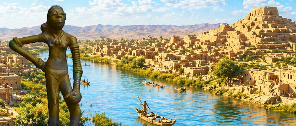
Between roughly 3300 BCE and 1300 BCE, thriving cities such as Mohenjo-Daro and Harappa rose along its banks, shaped by its steady flow, with remarkably advanced urban planning, drainage systems, and trade routes reaching as far as Mesopotamia.
Mohenjo-Daro, in present-day Sindh, stood as one of the largest cities of the ancient world, home to an estimated 40,000 people at its peak. Among its most iconic discoveries is the bronze “Dancing Girl of Mohenjo Daro” statue, now housed in the National Museum in New Delhi, a powerful reminder of a civilization made possible by the Indus River’s ability to sustain organized, sophisticated human life.
The Indus River Today: Pressures and Challenges
The Indus River today faces severe pressure from three directions simultaneously. First, climate change is accelerating the melting of the Karakoram and Himalayan glaciers that feed it, increasing short-term flow but threatening long-term water availability. Second, upstream water use by India under the Indus Waters Treaty of 1960 diverts significant flow before the river reaches Pakistan. Third, Pakistan’s own agricultural demands extract water on a massive scale, leaving the Indus Delta critically deprived, where 18 of the delta’s 20 major creeks are now seasonally dry.
The 2022 floods, which submerged one-third of Pakistan and affected over 33 million people, demonstrated the Indus system’s capacity for catastrophic destruction when its flow is disrupted by extreme weather events, a pattern that climate scientists warn will intensify.
The 5 Rivers of Pakistan Or Punjab’s Founding Waters?
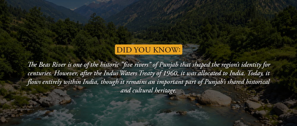
The name Punjab comes from the Persian words “Panj” meaning five and “Aab” meaning water. It refers to the land of five rivers: Jhelum, Chenab, Ravi, Beas, and Sutlej. After the Indus Waters Treaty of 1960, the Beas River was allocated to India and no longer flows into Pakistan’s river system.
Today, when Pakistanis refer to the “5 Rivers of Pakistan,” they usually mean the Jhelum, Chenab, Ravi, Sutlej, and Kabul rivers, which are part of the wider Indus basin.
These rivers turned Punjab into the breadbasket of the subcontinent. Over thousands of years, their floods deposited rich alluvial soil, creating some of the most fertile farmland in the world.
Later, a vast canal irrigation system built during British rule and expanded after Partition transformed much of the region into highly productive agricultural land, which continues to support Pakistan’s food production today. Let’s talk about the five rivers today:
1. Jhelum River
The Jhelum River rises from the Verinag Spring in the Kashmir Valley at an altitude of approximately 1,876 meters. It is the westernmost of the five Punjab rivers and the first to enter Pakistan from the east, flowing through Azad Jammu & Kashmir before entering Punjab.
- Total length: approximately 725 km, of which around 400 km flows through Pakistan
- Historical significance: the Jhelum is the ancient Hydaspes River of Greek history, the site of Alexander the Great’s last major battle in 326 BCE, when he defeated the Indian king Porus
- Major dam: Mangla Dam, completed in 1967, is Pakistan’s second-largest reservoir and a critical source of irrigation water for Punjab and hydroelectric power for the national grid
- Cities along the Jhelum: Mirpur, Jhelum city, and the broader Pothohar Plateau region depend on the river for water supply
2. Chenab River
The Chenab is the largest of the five Punjab rivers measured by water volume. It originates in the Himachal Pradesh region of India, at the confluence of the Chandra and Bhaga rivers near Lahaul, and enters Pakistan through Punjab after flowing approximately 960 km total.
- Flow in Pakistan: approximately 680 km
- Agricultural role: the Chenab is the primary water source for central Punjab’s most productive agricultural districts, including Gujranwala, Faisalabad, and Multan
- Major infrastructure: Trimmu Headworks and Marala Headworks are key barrages that distribute Chenab water into Pakistan’s canal network
- Historical significance: the Chenab plain was the heartland of the Mughal Empire’s agricultural wealth and remains the geographic center of Pakistan’s rural economy today
3. Ravi River
The Ravi is the smallest of the five Punjab rivers in terms of current water flow, but its historical and cultural weight is disproportionate to its size. It rises in the Kullu district of Himachal Pradesh and flows southwest into Pakistan, passing directly through Lahore, the cultural capital of Pakistan and one of the subcontinent’s oldest cities.
- Flow in Pakistan: approximately 280 km
- Lahore’s river: for centuries, the Ravi defined Lahore’s geography. The Mughal emperors built the Lahore Fort and Shalimar Gardens with the Ravi as their backdrop. The river was a symbol of the city.
- The tragedy of the Ravi today: following the Indus Waters Treaty of 1960, India gained rights to the Ravi’s water in its upper reaches. Today, the Ravi arriving in Pakistan is heavily depleted. Near Lahore, the river that once carried the life of a great city now flows as a shallow, polluted stream for much of the year, carrying untreated industrial and domestic waste from both India and Pakistan.
- Restoration efforts: the Ravi Riverfront Urban Development Project in Lahore is a large-scale effort to restore the river’s ecology and create a new urban waterfront
4. Sutlej River
The Sutlej has the longest journey of the 5 Rivers of Pakistan, originating at Rakshastal Lake on the Tibetan Plateau at approximately 4,572 meters altitude, and traveling over 1,500 km before reaching Pakistan. However, by the time it crosses into Pakistan’s south Punjab region, it has already passed through extensive irrigation diversions in India.
- Flow in Pakistan: approximately 250 km through South Punjab before joining the Chenab near Bahawalpur
- Water reduction: the Sutlej was allocated to India under the Indus Waters Treaty. Pakistan’s Sutlej today carries only residual and floodwater flows, severely limiting its irrigation contribution
- Historical role: the Battle of Ferozeshah (1845) and multiple Sikh Wars were fought along the Sutlej, the river formed the border between Sikh Punjab and British India before Partition
- Bahawalpur connection: the ancient princely state of Bahawalpur, once one of the wealthiest in the subcontinent, built its prosperity on Sutlej irrigation
5. Kabul River
While not traditionally one of the five Punjab rivers, the Kabul River is one of Pakistan’s most important waterways and a major tributary of the Indus. It originates in the Sanglakh Range of Afghanistan, flows through Kabul city, crosses into Pakistan at the Durand Line near Torkham, and joins the Indus at Attock.
- Length in Pakistan: approximately 290 km through Khyber Pakhtunkhwa
- Warsak Dam: the Warsak Hydroelectric Project on the Kabul River near Peshawar provides critical power to KPK province
- Strategic significance: the Kabul River valley is the historic gateway from Central Asia and Afghanistan into the Indian subcontinent. The Khyber Pass runs parallel to the river, whoever controlled the Kabul River’s crossing points controlled access to the subcontinent
- Afghanistan dependency: the Kabul River’s flow is significantly influenced by upstream conditions in Afghanistan, making Pakistan’s water planning in KPK partially dependent on Afghan water management, a geopolitical dimension unique among Pakistan’s rivers
Rivers of Pakistan Map: Reading the Water
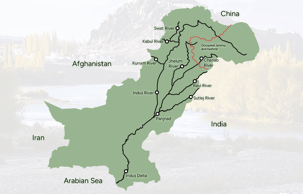
A rivers of Pakistan map reveals one of the most striking patterns in the country’s physical geography: almost every major river in Pakistan flows from northeast to southwest, following the tilt of the subcontinent away from the Himalayan and Tibetan highlands toward the Arabian Sea. This directional unity means that all of Pakistan’s rivers, from the Kabul in the northwest to the Sutlej in the east, eventually converge into the Indus before reaching the sea.
This convergence point, the Panjnad (meaning “five rivers meeting”), where the Jhelum, Chenab, Ravi, and Sutlej all join before flowing into the Indus, is located in south Punjab near Bahawalpur. It is one of the most geographically significant points in Pakistan, the place where the Punjab river system merges into the single great waterway that defines the entire country.
How to Read a Rivers of Pakistan Map
- The Indus appears as the dominant central artery, running from Gilgit-Baltistan through KPK, Punjab, and Sindh to the Arabian Sea
- Eastern tributaries (Jhelum, Chenab, Ravi, Sutlej) join from the left (east), fed by Himalayan snowmelt
- Western tributaries (Kabul, Swat, Kurram) join from the right (west/northwest), fed by Hindu Kush and Afghan highland sources
- The dense canal network in Punjab shows as fine blue lines branching from the main rivers, this is the irrigation system that makes Punjab the country’s agricultural engine
- The Indus Delta appears at the southern tip where the river fans into multiple channels before meeting the sea
The Indus Waters Treaty: The Agreement That Divided Pakistan’s Rivers
No discussion of Pakistan’s rivers is complete without the Indus Waters Treaty of 1960, one of the most consequential water agreements in world history, and one that continues to define Pakistan’s water security today.
Negotiated over nine years with World Bank mediation, the treaty was signed on September 19, 1960 by Pakistan’s President Ayub Khan and India’s Prime Minister Jawaharlal Nehru. It divided the six rivers of the Indus system between the two countries:
- Allocated to Pakistan (Western Rivers): Indus, Jhelum, Chenab, Pakistan received unrestricted use of these three rivers
- Allocated to India (Eastern Rivers): Ravi, Beas, Sutlej, India received unrestricted use of these three rivers
For Pakistan, the treaty meant losing the water of the eastern rivers, the Ravi, Beas, and Sutlej, which had previously irrigated vast portions of Punjab. As compensation, India was required to fund the construction of the Link Canal system, which transferred water from the western rivers to replace what the eastern rivers had provided. Pakistan received approximately 62% of the total Indus system water flow.
The treaty is often cited as one of the world’s most durable water agreements, it survived three wars between India and Pakistan, but Pakistan has repeatedly raised concerns about Indian dam construction on the western rivers, arguing it violates treaty provisions. In 2023, Pakistan formally requested modification of the treaty, signaling ongoing tensions over its implementation.
Rivers as Stories: What Rava Documentary Films Sees in Pakistan’s Waters
At Rava Documentary Films, we believe that geography is not a backdrop to human stories, it is the story. Pakistan’s rivers have been the setting for some of the most important and least-documented events in South Asian history.
The Indus carried the commerce of Mohenjo-Daro’s traders. The Jhelum witnessed Alexander’s armies. The Ravi flowed through the Mughal courts of Lahore. The Chenab irrigated the land that fed empires. The Kabul River was the corridor through which invaders, traders, and pilgrims have moved for millennia. And the Sutlej divided armies in wars that shaped the modern subcontinent.
These are not geography lessons. They are the hidden chapters of Pakistan’s story, the ones told not by politicians or generals, but by the water.
The Future of Pakistan’s Rivers: Challenges and Responsibility
Pakistan is one of the most water-stressed countries in the world, and the pressure on its rivers is increasing. At the same time, these challenges also highlight where better planning, investment, and cooperation can secure a stronger water future.
Climate Change and Glaciers
Pakistan is home to more glaciers than almost anywhere outside the polar regions, with over 7,200 glaciers in the Karakoram, Himalaya, and Hindu Kush ranges. These glaciers act as natural water reservoirs, feeding the Indus River system, especially during the summer months.
With rising global temperatures, glaciers are melting faster. In the short term, this increases river flows, but over time it reduces stored ice that sustains long-term water supply. Scientists estimate that many glaciers in the region could lose a significant portion of their volume by 2100, making long-term water management even more important for the more than 200 million people who depend on this system.
Population and Agricultural Demand
Pakistan’s population has grown from about 33 million in 1947 to over 230 million today. This rapid growth has increased the demand for water, especially in agriculture, which uses around 90% of the country’s freshwater.
This makes water efficiency, improved irrigation methods, and better crop planning key opportunities to strengthen food and water security for the future.
Transboundary Water Cooperation
Pakistan’s rivers are part of a wider shared system, with headwaters in India, China, and Afghanistan. The Indus Waters Treaty provides a long-standing framework with India, while opportunities remain to strengthen cooperation with other upstream neighbors, especially on shared rivers like the Kabul.
Improved regional coordination and data sharing can play an important role in managing water more predictably and fairly.
Water Quality and Pollution
Water quality is another major area for improvement. Rivers such as the Ravi and parts of the lower Indus receive untreated wastewater from cities and industries. This puts pressure on ecosystems and limits safe water availability.
At the same time, it also presents a clear opportunity: investing in modern wastewater treatment and cleaner industrial practices can significantly restore river health over time.
Conclusion
The rivers of Pakistan are not just featured on a map. They are the reason Pakistan exists where it does, the reason its cities were built where they were, the reason its people have farmed the same plains for 5,000 years. The Indus River’s length of 3,180 kilometers traces the spine of the entire country. The five rivers of Punjab gave the province its name and its purpose. The Kabul River carried the footsteps of armies and traders for millennia.
Understanding the rivers of Pakistan is understanding Pakistan itself, its history, its vulnerabilities, its extraordinary agricultural heritage, and its uncertain water future. These rivers are also Pakistan’s most urgent story: one of climate pressure, geopolitical negotiation, and 220 million people whose lives depend on water that is increasingly scarce.
At Rava Documentary Films, we tell the untold stories of Pakistan, the stories its geography has shaped, its rivers have carried, and its people have lived. From the Lansdowne Bridge standing above the Indus at Sukkur to the Dancing Girl emerging from Mohenjo-Daro’s river-fed civilization, Pakistan’s waterways run through our documentaries the way they run through the land: as the source of everything.