At the crossroads of South and Central Asia, Pakistan occupies a location of immense strategic significance. It borders China, India, Afghanistan, and Iran and lies near major sea routes through the Arabian Sea. Its position has made it a gateway for trade, culture, and geopolitics for centuries.
This strategic advantage, combined with its rich natural resources, gives Pakistan tremendous potential to become a regional hub for commerce, energy, and connectivity.
Beyond its strategic value, Pakistan is also a country of great natural beauty. From the high mountains in the north to the wide Indus River plains, and from deserts to coastlines, its geography is rich and diverse.
This strategic geography of Pakistan is what keeps it going. Let’s break it down and see what promise and potential this land holds.
Geographic Location of Pakistan and Its Strategic Importance
The geography of Pakistan plays a vital role in developing the country’s history, economy, defense, and international relations. The Pakistan map places the country in South Asia, connecting it to Central Asia, the Middle East, and China. This significant location gives Pakistan greater geographical importance than its physical size.
If we pay close attention to the map of Pakistan, it shows that the country covers about 881,913 square kilometers. It is located between latitudes 23° and 37° North and longitudes 60° and 77° East. The geography of Pakistan features high mountains, fertile plains, deserts, rivers, plateaus, and a long coastline, making it one of the most physically diverse countries in the region.
An important aspect of the Geography of Pakistan is its international boundaries, the neighboring countries with which it shares its dividing lines. These include China in the north, Afghanistan in the northwest, Iran in the west, and India in the east. The Pakistan Map also shows its southern coastline along the Arabian Sea, which provides access to major international trade routes.
From the great Indus River to the high mountain ranges of K2, and from the busy Karachi port to the developing Gwadar Port, the Geography of Pakistan strongly influences economic activity, cultural development, and regional connectivity. Understanding the Geography of Pakistan is essential for analyzing national development and foreign relations.
Borders and Neighbours of Pakistan
The Pakistan-China Border:
Among the Neighbours of Pakistan, China shares a mountainous border with Pakistan in the Gilgit-Baltistan region, connected through the Khunjerab Pass, which serves as the main physical gateway between the two countries. It is located within the Karakoram mountain range. The Khunjerab Pass lies at an altitude of about 4,693 meters (15,397 feet), making it one of the highest surfaced international border crossings in the world.
The region experiences harsh climatic conditions with long winters and heavy snowfall, while summers are short and cool. Even with a harsh environment, the Pakistan-China border has significant geographical and strategic importance. It is an important connector in regional connectivity and reflects the strong all-weather friendship between Pakistan and China, based on trust, cooperation, and long-term relations.
Learn More
To better understand the trust and all-weather friendship between Pakistan and China, watch Episode 1 of Zafar Hilaly by Rava. In this episode, he explains the early diplomatic foundations of Pakistan-China relations.
- Karakoram Highway: A Key Feature of the Geography of Pakistan
Serving as the main transport route, the Karakoram Highway (KKH) connects Kashgar, in China’s Xinjiang region, with Islamabad, the capital of Pakistan. Covering approximately 800 kilometers (500 miles), the highway took nearly 20 years (1959–1978) to complete and passes through some of the roughest and hardest-to-reach lands in Asia. Along its route, it passes through or near the Pamirs, Hindu Kush, Kunlun Mountains, and the Karakoram Range; therefore, it is one of the highest and hardest highways in the world.
Starting from Kashgar, the highway heads south through deep valleys, enters Gilgit-Baltistan at the Khunjerab Pass, and follows the upper Indus River valley near Nanga Parbat before turning toward Islamabad. Built together by Pakistan and China, it involved around 24,000 workers and faced dangers such as landslides, rockfalls, and glaciers. Even with these challenges, the Karakoram Highway has become an important trade route, bringing economic benefits to local communities and reflecting engineering excellence and the cooperation between Pakistan and China.
- China-Pakistan Economic Corridor (CPEC)
(CPEC) stands for China-Pakistan Economic Corridor, a long-term development partnership between Pakistan and China, and a landmark project of China’s One Belt, One Road (OBOR) initiative. It is designed to support Pakistan’s economic growth and regional connectivity, making the country a connecting link between China, South Asia, Central Asia, and the Middle East. CPEC is a game-changer for Pakistan because it promotes infrastructure, energy, trade, and investment, while strengthening the partnership between the two countries.

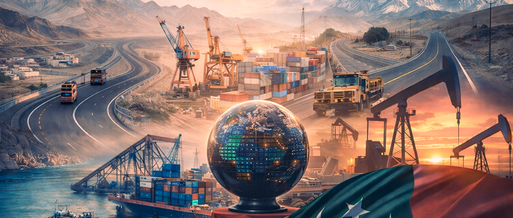
Phase I of CPEC focused on priority projects, especially in energy and transport infrastructure, to address Pakistan’s economic challenges. While Phase II of CPEC was designed to focus more on industrial cooperation, Special Economic Zones (SEZs), agriculture, technology transfer, and long-term development. CPEC is important because it can boost socio-economic growth, strengthen regional connections, and maintain stability if there is political unity, transparency, strong security, and local skill development.
Pakistan-Afghanistan Border
Forming a boundary of approximately 2,600 km, the Pakistan-Afghanistan border, commonly known as the Durand Line, is one of the most sensitive boundaries among the Neighbours of Pakistan, extending from Iran in the southwest to China in the northeast. It passes through rough border areas of Khyber Pakhtunkhwa and Balochistan, making it one of the most challenging borders in South Asia. Established in 1893 during British rule, the Durand Line has been recognized and accepted by Pakistan as the international border since 1947, and plays an important role in security, travel, and trade across the border.
Even with political challenges, Pakistan has traditionally supported Afghanistan through trade and trade routes, a country that has no sea access. Pakistan helps Afghanistan reach international markets through its roads and seaports, especially Karachi and Gwadar. The main border entry points are Torkham and Chaman, which are used for trade, aid supplies, and regional connections.
Relations along the Pakistan-Afghanistan border continue to experience ongoing disagreements between the two countries, including commercial travel, humanitarian aid, and the return of Afghan citizens. The Annual 2024 Report of IOM, International Organization for Migration, highlights Pakistan’s ongoing role in managing migration flows, hosting Afghan populations, and cooperating with international organizations to ensure safe and orderly movement across the border.
The Wakhan Corridor
In the Northeastern Afghanistan, within the Badakhshan Province, lies the Wakhan Corridor, a narrow strip of land. It is about 210 km long and 20-60 km wide, located between Pakistan in the south and Tajikistan in the north, and it separates Pakistan from Central Asia. On its eastern side, the corridor connects Afghanistan with China.
This passageway was constructed in the late 19th-century to protect British India from the Russian Empire. Its purpose was to keep the two powers separate. As a result, the Wakhan Corridor separates Pakistan from Central Asia, which is why Pakistan does not share a direct land border with Tajikistan.
Geographically, it is located in a high mountain area, surrounded by the Pamir and Hindu Kush ranges, near Bam-e-Duniya (the Roof of the World). It has a very cold climate and rough land, which makes travel difficult. Although it is remote, it has significant physical and regional importance due to its location near Gilgit-Baltistan and the Karakoram region.
Pakistan-Iran Border
Covering a distance of around 900 kilometers, the Pakistan-Iran border runs through Balochistan, connecting Pakistan with Iran’s Sistan-Baluchestan Province. This boundary is an important part of the Geography of Pakistan, providing land access to the Middle East. Among the Neighbours of Pakistan, Iran plays a key role in energy cooperation and regional trade.
Trade across the border takes place mainly through Taftan and Gabd-Rimdan crossing points. However, trade between the two countries remains limited to this day due to safety concerns, weak infrastructure, and international restrictions on Iran, but the border facilitates energy cooperation and local trade. If transport and border control improve, the Pakistan-Iran border can become an important trade route for Pakistan.
Pakistan-India Border
The Pakistan-India border, called the Radcliffe Line, was established on 17 August 1947 by Sir Cyril Radcliffe. It is Pakistan’s longest land border, about 2,912 kilometers long, without including the Line of Control in Jammu and Kashmir.
Wagah, a road situated along the historic Grand Trunk Road on the Redcliffe Line between Lahore, Pakistan, and Amritsar, India, is the main land route between the two countries and is famous for its daily flag-lowering ceremony, symbolizing both tension and shared history.
The border passes through Punjab, Sindh, and Azad Jammu & Kashmir in Pakistan, and across Punjab, Rajasthan, and Jammu & Kashmir in India. Major Pakistani cities near this border include Lahore, Sialkot, Kasur, and Bahawalpur. The boundary runs through agricultural plains, rivers, deserts, and hilly areas, mainly in Punjab, where the same climates and landscapes are found on both sides.
The Coastline of Pakistan and the Arabian Sea
Pakistan possesses a coastline of about 990 kilometers along the Arabian Sea, divided into the Sindh Coast and the Balochistan (Makran) Coast. From the Gulf of Oman near Iran to the Sir Creek near India, this coastal feature strengthens the geography of Pakistan by supporting the maritime trades, fisheries, and port development.
Gwadar Port:
Pakistan’s only deep-water port, Gwadar, lies on the Balochistan coast close to the strategic Strait of Hormuz. Declared a tax-free economic zone, it is expected to become a regional trade hub, improving Pakistan’s importance in the Arabian Sea.
Karachi Port:
The main seaport of Pakistan, the Karachi Port, manages nearly 70% of the country’s cargo. Located close to the main sea routes near the Strait of Hormuz, it serves as the backbone of Pakistan’s foreign trade and industrial supply.
Provinces of Pakistan:
1. Sindh

Karachi is the capital and largest city in Sindh. It is Pakistan’s leading economic and financial center, with major ports, industries, and financial organizations. The Indus River system and the Indus Delta are also one of the most important parts of the province, as they support fisheries, agriculture, and coastal communities.
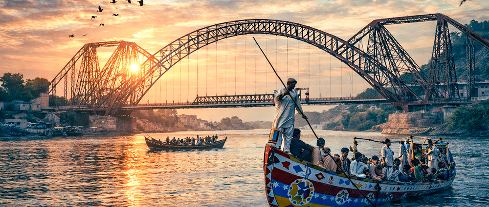
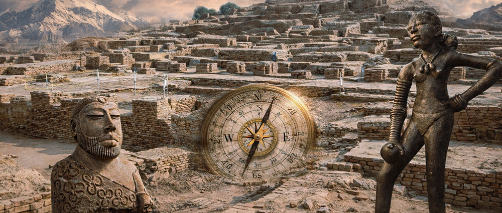
This province also has well-known historical monuments, such as the Priest King in Mohenjo-Daro, the counterpart of the Dancing Girl present in the National Museum of India and the Lansdowne Bridge, which connects Sukkur and Rohri and supported trade and railway transport during British rule.
2. Punjab
Punjab, Pakistan’s most populous province, plays a crucial role in the country’s economy and geography. Known as the ‘breadbasket of Pakistan,’ it produces the majority of the nation’s crops, supporting food security and agriculture-based industries.
Strategically located with major rivers like the Indus and Chenab, Punjab also serves as a key link between Pakistan’s northern and southern regions, making it vital for trade, transport, and overall national connectivity.
Pakistan’s capital, Islamabad, is also geographically and economically tied to Punjab. The Pakistan map shows how it’s located on the northern edge of the province. It benefits from Punjab’s fertile plains, major transport routes, and industrial hubs.
3. Khyber Pakhtunkhwa
Peshawar is the capital of Khyber Pakhtunkhwa, a region of rough mountains and flowing rivers that attract visitors from across the country. Its location near Afghanistan gives it a major role in regional connectivity, while its water-based energy sources and natural scenery add to Pakistan’s natural and economic strength.
4. Balochistan

Quetta is the capital of Balochistan, Pakistan’s largest province by area. The province is full of natural resources, including minerals and natural gas, and has a long coastline, with important ports like Gwadar. The Hinglaj Mata Temple, located in Hingol National Park in Balochistan, is an important Hindu religious place in South Asia and represents the different religious cultures of Pakistan.
Explore Further
For deeper insight into the history and spiritual importance of the Hinglaj Mata Temple, watch this documentary feature produced by Rava Studios.
Administrative Regions and Federal Territory
1. Islamabad Capital Territory
Islamabad, the capital of the Islamabad Capital Territory, serves as Pakistan’s administrative and political hub. It contains major state institutions as well as foreign representatives.
2. Azad Jammu & Kashmir (AJK)
Muzaffarabad is the capital of Azad Jammu & Kashmir. The region is known for its green valleys, rivers, and hilly landscape, and it supports tourism, water-based energy, and local culture.
3. Gilgit-Baltistan
Gilgit is the capital of Gilgit-Baltistan, an administrative unit known for its high mountain ranges, which contain several of the world’s highest peaks, including K2, Nanga Parbat, and Gasherbrum I. It also supports tourism, water-based energy, and local culture.
Rivers of Pakistan
The river system is a very important part of the Geography of Pakistan and supports agriculture, settlements, and economic activity across the country. Without this river system, the Geography of Pakistan would not be able to support such a large population and overall development.
1. Indus River:
The Indus River is Pakistan’s largest and most important river. It flows from the Tibetan Plateau near Lake Mansarovar and flows south through Gilgit-Baltistan, Khyber Pakhtunkhwa, Punjab, and Sindh before merging into the Arabian Sea. The Indus River provides the main water supply for irrigation across Pakistan and is used for agriculture, hydropower production, and the daily water needs of millions of people.
Situated along the Indus River in Sindh, the Lansdowne Bridge, completed in 1889 under British rule, stands as a landmark of early steel engineering. By connecting the cities of Sukkur and Rohri, it became an important railway connection that supported regional trade and transport, helping move trade cargo and passengers between northern and southern Sindh and strengthening the area’s role as an important trading corridor.
Learn More
For more information on the historical, engineering, and economic importance of the Lansdowne Bridge, watch this detailed documentary by Rava.
2. Jhelum River:
The Jhelum River rises in Verinag, the Kashmir region under Indian administration, and flows through Azad Jammu & Kashmir and Punjab. It is an important source of hydroelectricity and Water supply for crops, with major dams like Mangla built on it.
3. The River Chenab:
The Chenab River flows from the Himalayan mountains and enters Pakistan through Punjab. It plays a significant role in crop cultivation and water supply, especially in central Punjab.
4. Ravi River
The River Ravi runs along sections of the Pakistan–India border and flows near Lahore. Even though the flow has decreased due to water use in the upper regions, it remains historically and geographically important.
5. Sutlej River:
The Sutlej River is an eastern branch of the Indus River system and flows through southern Punjab. It supports irrigation, but today its water flow has reduced due to water-use agreements.
6. Kabul River:
The Kabul River begins in Afghanistan and flows into the Indus near Attock. It provides water for farming and electricity, which are essential for Khyber Pakhtunkhwa.
Mountains of Pakistan
Pakistan contains some of the highest and roughest mountain systems in the world, mainly located in its northern regions, making them essential to understanding the overall Geography of Pakistan, including its river systems, natural defenses, and future opportunities.
The Karakoram Range
The Karakoram Range is located in northern Pakistan and is among the world’s highest mountain ranges. It includes many high peaks rising above 7,000 meters and contains four of the world’s fourteen highest mountains, making it a popular destination for high mountain climbing.
– K2 (Mount Godwin-Austen)
The second-highest mountain in the world, K2, is located in the Karakoram Range and sits at 8,611 meters. Famous for its sharp ridges and extreme weather, it is regarded as one of the most challenging mountains to climb and a symbol of Pakistan’s rough landscape.
Himalayas
The Himalayan range enters Pakistan in the northeast and includes famous peaks such as Nanga Parbat. These mountains form a natural boundary and make a major contribution to the glacier systems that provide water to Pakistan’s rivers.
Nanga Parbat
Nanga Parbat is located near the Indus River and is one of the world’s highest isolated peaks. It is commonly called the “Killer Mountain”. Its sharp rise from the surrounding valleys makes it one of Pakistan’s most recognizable landmarks.
The Hindu Kush Range
The Hindu Kush range extends across northwestern Pakistan into Afghanistan. Its highest peak in Pakistan, Tirich Mir, rises over the Chitral region and affects the local climate and river sources.
Sulaiman Range
The Sulaiman Mountains are found in western Pakistan, mainly in Balochistan and southern Khyber Pakhtunkhwa. They act as a natural barrier and have affected migration and defense over time.
Kirthar Range
The Kirthar Mountains follow the Sindh–Balochistan border. While they are not as high as the northern ranges, they still mark Sindh’s western limit and include higher areas such as Gorakh Hill.
The Salt Range
The Salt Range is found in northern Punjab and contains large rock salt deposits. It is among the oldest mountain ranges in Pakistan and is economically and historically significant.
Conclusion:
Pakistan’s geography is more than a collection of rivers, mountains, and borders; it is the silent force that has shaped its history, culture, and future. The Indus River continues to act as a lifeline, sustaining agriculture and millions of lives across the fertile plains of Punjab and Sindh. In the north, the Karakoram, Hindu Kush, and Himalayan ranges rise not only as symbols of natural beauty but also as gateways that connect Pakistan to China and Central Asia through historic trade routes and strategic passes. To the south, the Arabian Sea coastline and major ports place Pakistan at a vital point for global maritime trade.
At RAVA Documentary Films, we tell the untold and often forgotten stories of Pakistan, the stories rooted in its land, its people, and its strategic place on the world map. Through our documentaries, we highlight the beauty of Pakistan’s landscapes while also bringing awareness to the immense geopolitical and economic potential of its location. By documenting these realities, RAVA aims to remind audiences, both locally and globally, of Pakistan’s importance, resilience, and the powerful role its geography continues to play in shaping the region and the world.
Frequently Asked Questions:
- How does Pakistan’s geography influence its regional trade and strategic importance?
Pakistan’s location at the crossroads of South Asia, Central Asia, China, and the Middle East enables it to act as an economic route and connectivity hub, especially through routes like the Karakoram Highway and ports such as Gwadar
- Which river is known as the lifeline of Pakistan?
The Indus River is called the lifeline of Pakistan due to its central role in agriculture and water supply.
- Why is water management a critical challenge for Pakistan today?
Rapid population growth, climate change, glacier melt, and inefficient water use have increased pressure on Pakistan’s river system, making adaptive water management a national priority.
- Which is the largest fort of Pakistan?
Ranikot Fort in Sindh is Pakistan’s largest fort and is often called the “Great Wall of Sindh.”
- Why do Pakistan’s mountains and rivers matter beyond natural beauty?
Pakistan’s mountains and rivers are not just landscapes; they have shaped trade routes, settlement patterns, defense strategies, and regional connectivity for centuries. From ancient caravan paths to modern corridors like CPEC, geography continues to influence how Pakistan connects with its neighbors and the world.